|
Where: Dungeon Hill in Dumfries &
Galloway by Ayrshire
When: June 2013
Who: I Parker
Why: good weather so a day out
Weather: Sunny Spells
Height: 2,001ft / 607M
Distance: ?
The south side of the Dungeon Range is
hiked from Loch Trool, by Glentrool
village, 34 miles southeast of Ayr via the
village of Straiton, or 9 miles north of
Newton Stewart in the county of Dumfries
& Galloway. The Village is about 30
houses with a popular small Hotel for
drinks and meals. The Hotel is about 1 mile
south of the village, named the House o Hill. The Glentrool
Holiday Park for camping is close to
the Village.
Glentrool Park is mile east of Glentrool
village with a visitor centre, a few car
parks, and many walk/cycle paths
throughout.
Below is a view of the Glentrool
Visitor Centre with parking for many
cars and signs giving information on the
walking and biking trails throughout the
park, and around Loch Trool. The signs also
give information on astrology as this area
is so remote, it is classed as a dark skies
area, one of the top areas in the UK for
viewing the stars.
The car parks for the hills/mountains in
this area are 3 miles east of here via a
good single lane, tar road, with many
passing places. Road
Map
Large Walking
Routes Map
|
|
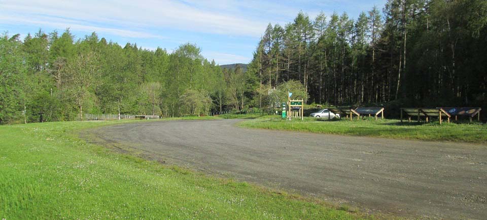
Below is a view of the Bruce's Stone car
park 3 miles east of the Glentrool Visitor
Centre. The old road past the Monument is
loose surface, you are not meant to drive
past this point. This car park at the
Monument can hold about 12 cars, and
another car park 3 hundred yards before the
stone holds about 30 cars.
The well marked Merrick Hiking Trail
begins from the sign in the image below.
This is the most popular hill in southwest
Scotland, so there will normally be a few
cars in the car park. Weekends and
holidays, you may have to park in the
larger car park 300 yards back down the
road.
The route to the south side of the
Dungeon Range is follow the road out east,
round to the right past the Merrick
sign.
|

|
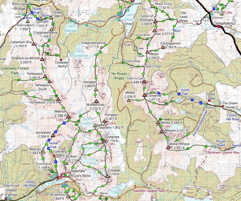
The map below shows the Dungeon Range,
or Mullwarchar Range, that runs from Loch
Dee in the south to Loch Doon in the north.
The map shows the different routes that can
be taken.
This photo tour starts at the car parks
at Bruce's Stone and follows the old road
just over 2 miles east towards Loch Dee.
The tour then follows a path through a gate
and up onto the south side of Craiglee,
north to Craignaw, north to Dungeon, across
to Craignairy, then back over Craignaw and
down past Loch Valley back to the car
parks.
|
|
The image below is from the old road a
few hundred yards out from the car park,
just past the narrow stone Buchan Bridge.
This is the Loch Valley Trail that runs
alongside Buchan Hill and up to Loch
Valley.
This is the trail this hike will be
returning back down. You can also return
over the top of the Buchan Hill range.
|
|
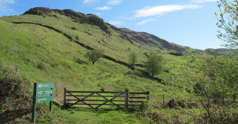
The image below is from just over two
miles out from the car park along the old
road, not far before Loch Dee. This image
shows the route onto the south ridge of
Craiglee, the furthest south hill on the
Dungeon Range.
It took about 40 minutes to hike out to
here from the car park.
|
|
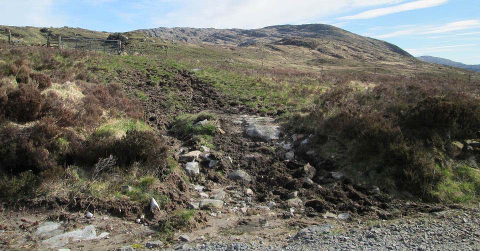
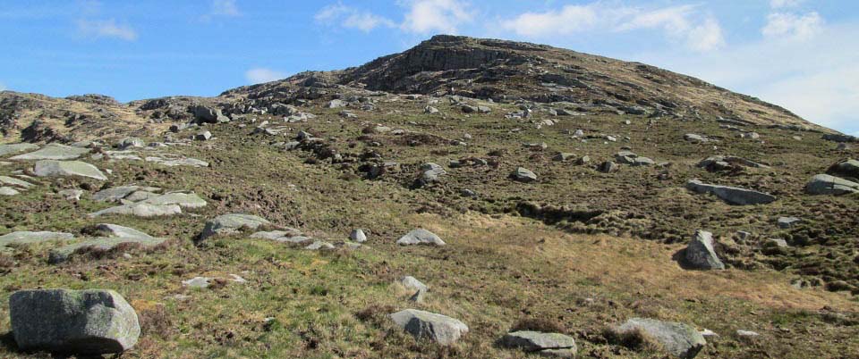
The image below is of the route up the
south ridge of Craiglee past the cliffs.
There was a flat area just below here of
fairly deep heather that was not the best
hiking, but after that, this is a really
good route. It took about 50 minutes to get
from the gate to the top.
|
|
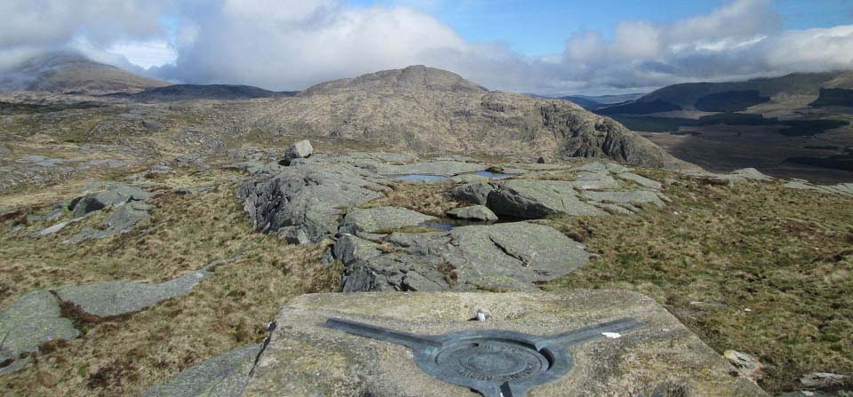
The view below is from Trig Point on
Craiglee looking north to Craignaw.
|
|
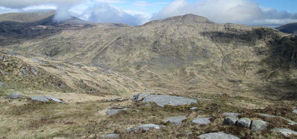
The view below is of the route over to
Craignaw. The OS Map stated there was no
ridge across here which I found hard to
believe. Only when I got to this point, did
I realize it really was a long way down and
back up again. The low point down there is
below 700ft above sea level, so about 1,000
ft down and 1,400 ft back up.
I headed down the ridge to the left
here, across at the narrowest point that
was ok going following sheep tracks, then
up through the rocks on the south side of
Craignaw. The hike to the top of the first
ridge is steep, but good going through the
rocks.
The route up to the second ridge is
easier with two small cairns to make your
way to on top of the second ridge. From the
two small cairns, it is a good steady hike
to the summit. Just watch out for the
cliffs on the east side of visibility is
poor.
|
|
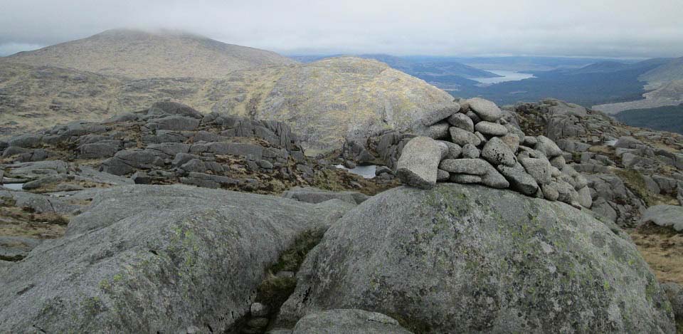
The view below is is from the top of
Craignaw looking north to Dungeon Hill in
the sun, and Mullwarchar in cloud.
There is a Memorial Plaque on a rock on
the top of Craignaw to pilots of an F-111
that crashed there on the 19th December
1979. I have been on this hill twice so far
and still to find the plaque.
The safest route over to Dungeon Hill
from here, is down and round to the left.
The other route is straight through the gap
in the rocks, as seen in the image below,
down a steep section for about 100ft named
the Devil's Bowling Alley, then follow the
ridge round to the left.
|
|
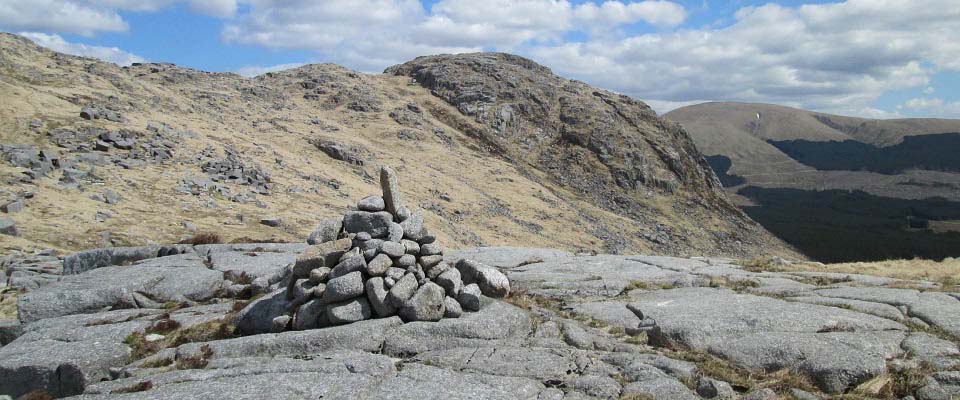
The view below is from a cairn on the
low point on the crossing. You can see a
faint trail leading over to Dungeon Hill.
The last part of the hike up to Dungeon is
through rocks. There are a few routes that
do not require rock climbing.
Craignairy Hill is just to the left in
this image.
|
|
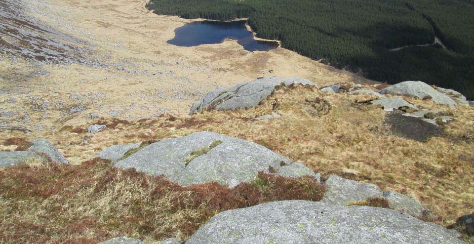
The image below is from Dungeon Hill
looking down the northeast side to Dry
Loch. Mind the cliffs on the east side of
Dungeon Hill as they are about 1,000
ft.
I hiked out from Loch Doon and down the
Dungeon Valley to Dry Loch and Dungeon Loch
a few days earlier. The weather was great
and there had been no rain for about a
week, so the trail down the valley was good
going. Got some good images of the cliffs
at Hoodens, Mullwarchar, Dungeon and
Craignaw, as well as the lochs.
|
|
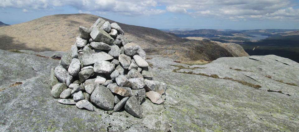
The image below is from the cairn on
Dungeon Hill looking north to Mullwarchar.
It is a fairly straight forward hike across
to Mullwarchar, once you have found your
way off the top section of Dungeon.
Mullwarchar is a fair slog to the top and
takes you well out from Loch Trool, turning
the hike into a long day.
I prefer to hike Mullwarchar from the
south side of Loch Doon via Craigmawhannel
and Hoodens hills. The hike up the narrow
north side of Hoodens past the cliffs is a
real good route.
|
|
The image below is from crossing over
west to Craignairy, that is joined to
Dungeon. In the low part down to the right
in this image, is a small cairn that marks
an aircraft crash site. There is a lot of
wreckage next to the cairn.
|

|
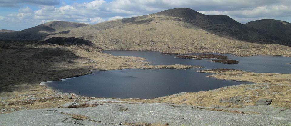
Below is an image from Craignairy
looking west to Loch Enoch and The Merrick.
Some hikers go round Loch Enoch, up the
southeast ridge of The Merrick, then back
to Loch Trool via The Merrick Trail over
Benyallery.
Another route is go round Loch Enoch to
the southwest corner, then follow the trail
from there onto the Buchan Hill range. That
range leads back to Buchan Bridge, a few
hundred yards east of the car park at
Bruce's Stone.
As the Buchan Range route is normally
used as the route back down from The
Merrick, and I had hiked that route before.
I planned to go back round Craignaw, down
the southwest ridge of Craignaw to Loch
Valley, then down the Loch Valley Trail to
Buchan Bridge.
|
|
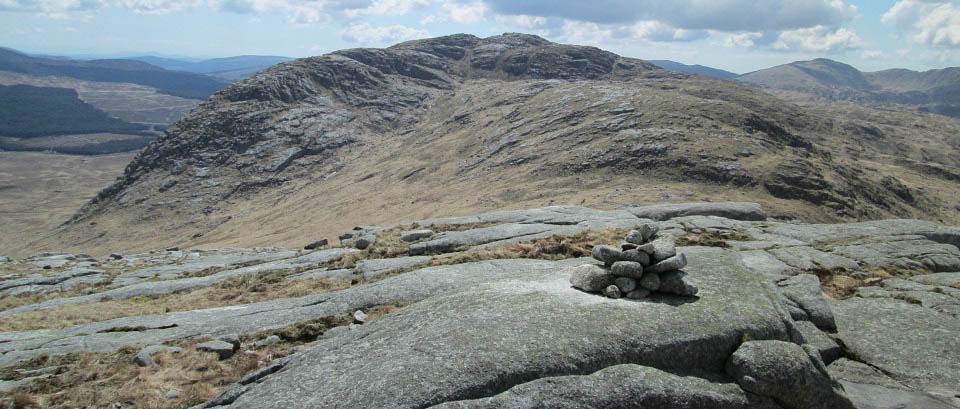
The image below is from Craignairy
looking south to Craignaw. You can see the
Devil's Bowling Alley route to the top of
Craignaw from here.
You can miss the top of Craignaw on the
return by going over the west shoulder, to
the right in this image, and head for the
two small cairns on the second ridge. From
the cairns, head down the southwest ridge
to Loch Valley. A straight forward route in
clear weather.
|
|
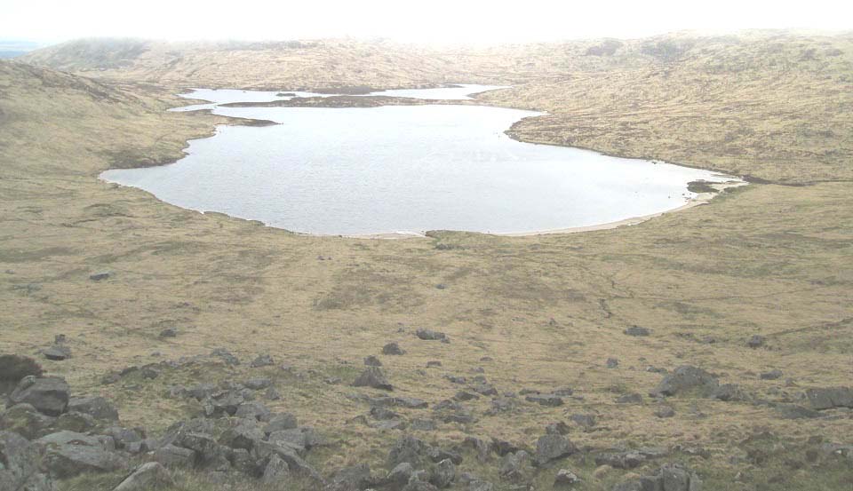
The view below is from the steep west
side of Craignairy looking across Loch
Neldricken.
The clouds rolled over when I was on top
of Craignaw, and I made the mistake of
heading southwest too early, ending up
going down the steep west side, rather than
the easier and more direct route down the
southwest ridge.
This let me know the steep west side is
not too bad a route down, and allowed me a
bit of a beach walk on the road back. The
beach is made up of a fine granite sand. A
narrow trail runs down the west side of
this loch all the way to Loch Valley, which
is only a few hundred yards south of this
loch. The Loch Valley Trail is supposed to
run all the way up to Loch Enoch, a very
narrow trail, mainly used by anglers and
sheep.
|
|
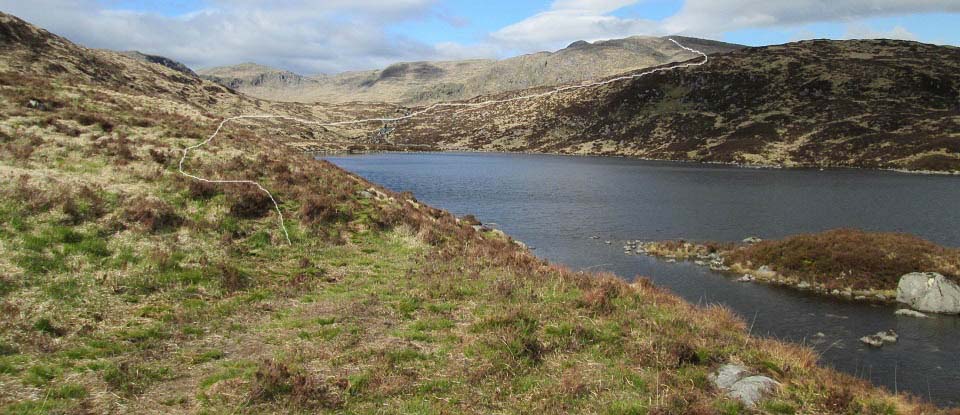
The view below is looking back across
Loch Valley to Craignaw. This view shows
the route I should have taken to here.
This is the fast way up if you are
missing out Craiglee and heading straight
for Craignaw and Dungeon. It takes about 1
hour to hike from the car park at Bruce's
Stone to here at Loch Valley, then probably
about 1 and a half hours from here to the
top of Craignaw.
The view from here looks like the west
side route I came down has un-passable
cliffs, but there are a number ways down.
These are probably the most dangerous hills
in southern Scotland, so best try and hike
them on clear days.
|
|
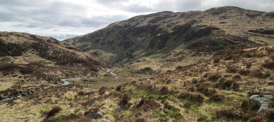
The image below is from Loch Valley
looking down the Loch Valley Trail. The
trail follows the Gairland Burn most of the
way down, then cuts over to the right and
down to the Buchan Bridge, only a couple of
hundred yards from the Bruce's Stone car
park.
The trail has a number of soggy parts,
even in a dry spell, so waterproof boots
and gaiters are needed.
|
|
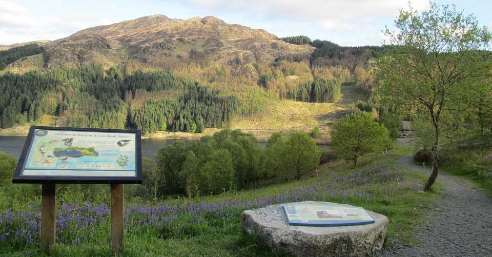
The image below is of Bruce's Stone at
Loch Trool in the evening with Mulldonoch
Hill over the loch. The hiking car park is
right next to the stone here.
|
|
The hike to Craiglee, Craignaw and
Dungeon will average about 7 hours.
If you want to hike the whole range in
one day, it is best to get dropped off at
the south side of Loch Doon and picked up
here at Bruce's Stone by Loch Trool.
The route up Hoodens narrow north side
ridge, past the cliffs, is the best way
onto the range. Down the whole range will
average between 9 and 11 hours.
Large Route
Map
North Dungeon
Range /Mullwarchar Range Page.
|
|
|
