|
Where: Corserine Range, from Loch Doon,
Ayrshire
When: July 11th 2012
Who: I Parker
Why: Good weather so a day out
Weather: Sunny spells
Distance: About 10 miles, 7 hours Carlin's
Cairn, Corserine and Meikle Craigtarson
only
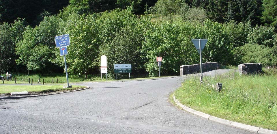
Loch Doon is situated about 3 miles east
of the town of Dalmellington, 18 miles east
of Ayr. The car park, as seen below, is
just over 1 mile east of Dalmellington next
to the road signed A713 to Castle Douglas
& Dumfries. From here, it is about two
miles to Loch Doon Dam, about seven miles
to Loch Doon Castle on the far southwest
side of the loch. This is a popular walk,
cycle or drive on a narrow hill road.
There are four hill ranges at the south
side of the loch that allow some
interesting hiking.
The range on the east side is known as
the Rhinns of Kells, containing from the
north, the 1,732 ft Black Craig, 2,043ft
Coran of Portmark, 2,011ft Bow, 2,162ft
Gairnsgarroch, 2,280ft Meaul, 2,648ft
Carlin's Cairn, 2,671ft Corserine, 2,034ft
Meikle Craigtarson, 2,349ft Millfire,
2,421ft Milldown, and 2,457ft Meikle
Millyea. Loch Doon
Map
Wide Image of
the four Ranges
|
|
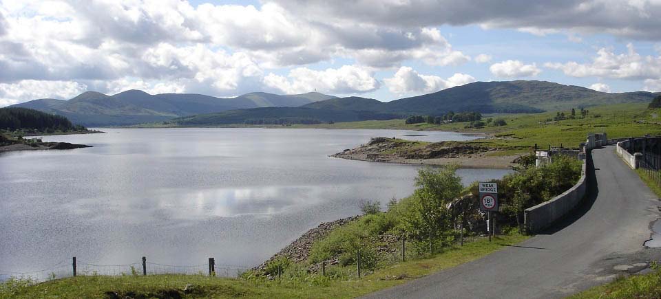
About two miles from the car park you
reach Loch Doon Dam. The dam was built in
1935 for generating hydro-electricity. This
is the largest inland loch in Southern
Scotland, about 7 miles long. The car park
for the hill walking is at the south side
of the loch. Carlin's Cairn is the hill
furthest away in the centre of the image
below, Corserine is behind it.
|
|
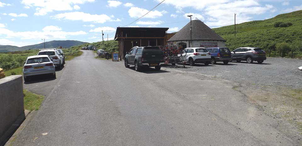
The Roundhouse Cafe is situated close to
Loch Doon Dam. The cafe is open 7 days a
week, most of the year. The popular Ness
Glen riverside walk trail starts here.
There are toilets here.
An Osprey feeding platform is situated
across the loch from the cafe for a pair of
Osprey that have been frequenting Loch
Doon, it is hoped they will breed here
soon. You can hire a large scope at the
cafe to view the birds or the mountains
across the loch.
|
|
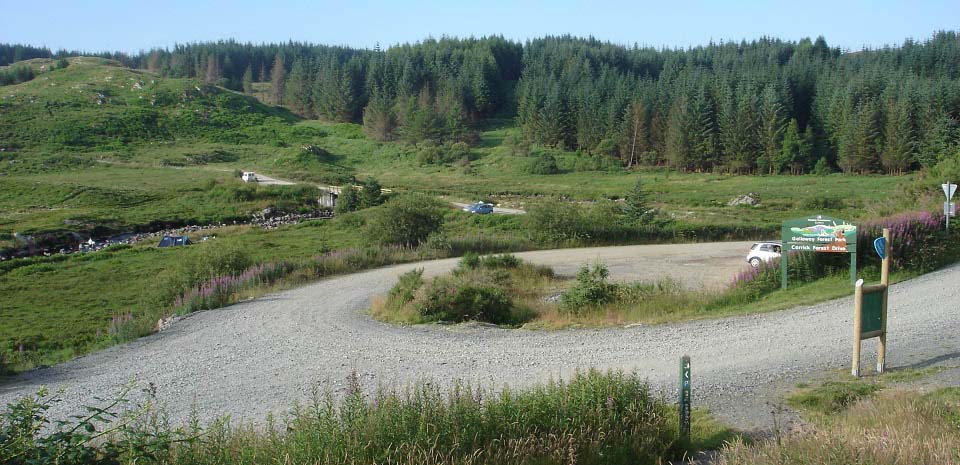
Below is a view of the hiking car parks
at the south side of Loch Doon. The road
leading off to the left is to the Rhinns of
Kells and Dungeon ranges.
The forest drive up to the right leads
about 3 miles to Loch Riecawr with parking
for the 2,520 ft Shalloch-on-Minnoch..
|
|
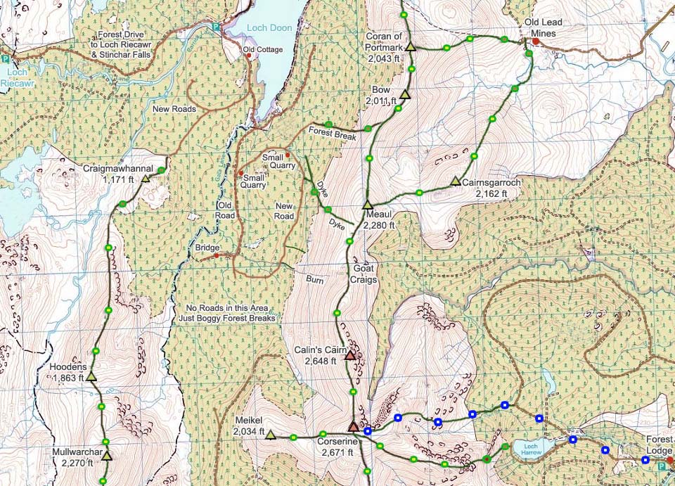
The map below shows the routes from the
car park at the south side of Loch Doon. It
is a two mile walk/cycle out to the quary
where you can choose three routes onto the
range.
The forest break onto the south side of
Meaul, following the stone dyke, is now the
shortest route onto these hills. The forest
break leads right to a stone dyke that runs
up onto the south side of Meaul.
The forest break up to Goat Craigs is
the longest and roughest. Before the new
roads, it was the only way up.
The forest break onto Bow is ok, but can
be a bit soggy in wet weather. That break
is flanked by mature woodland that is easy
to walk through next to the break.
You have to come back down one of these
routes to find the road back to Loch Doon.
If you descend further south than the burn
at Goat Craigs, there are no roads back to
Loch Doon from there, only thick woodland
and extremely boggy forest breaks.
The Map below also shows the routes up
from the east from the Old Lead Mines and
from Forest Lodge. The green and yellow
dots show the good trails, blue - tourist
trail, brown - rough trails, and red -
steep sections.
Larger
Map
|
|
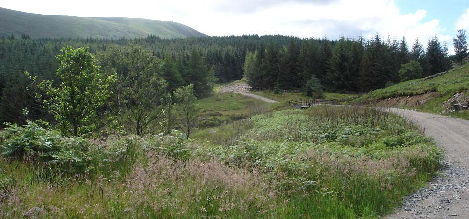
The image below shows the forest road
running round towards the Rhinns of Kells
Range with Carlin's Cairn the highest hill
to be seen from here. This is the main road
through here but take note of a couple of
new roads that lead off this road so as not
to follow the wrong road back. These roads
have no sign posts so it may be a good idea
to print the map above that shows the new
roads.
|
|
The image below is from the road that
runs up behind the Quary, looking up the
forest break that leads to the stone dyke.
You can just see the stone dyke in this
image leading right up onto the south side
of Meaul. This view also shows the steep
route up the west side of Meaul, about 100
yards left of the dyke, the grassy part
between the rocks.
This short forest break has quad tracks
that are easy to follow, but are a bit
soggy in places so waterproof boots and
gaiters are needed.
|
|
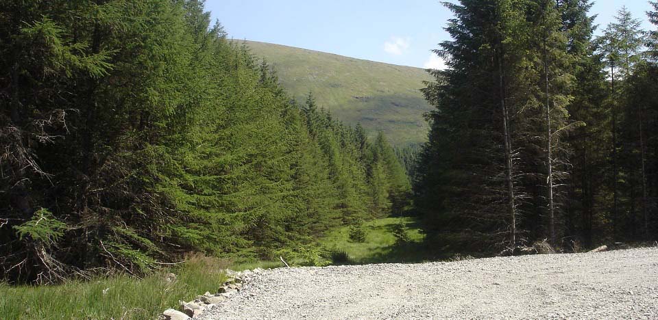
The image below is from the forest break
that follows the stone dyke. The path up
through the woodland beside the dyke is a
bit rough in places, but not too bad.
Should get better the more it is used.
If you are heading to Carlin's Cairn
first, you can start drifting to the right
as you go up, a lot easier route than going
straight up. If you want dramatic views of
Loch Doon from the steep west side of
Meaul, go up to the left here. The steep
west side of Meaul means you will have to
dig the toes into the hillside at the
steepest parts, it is that steep.
Large image
from the steep west side of Meaul
|
|
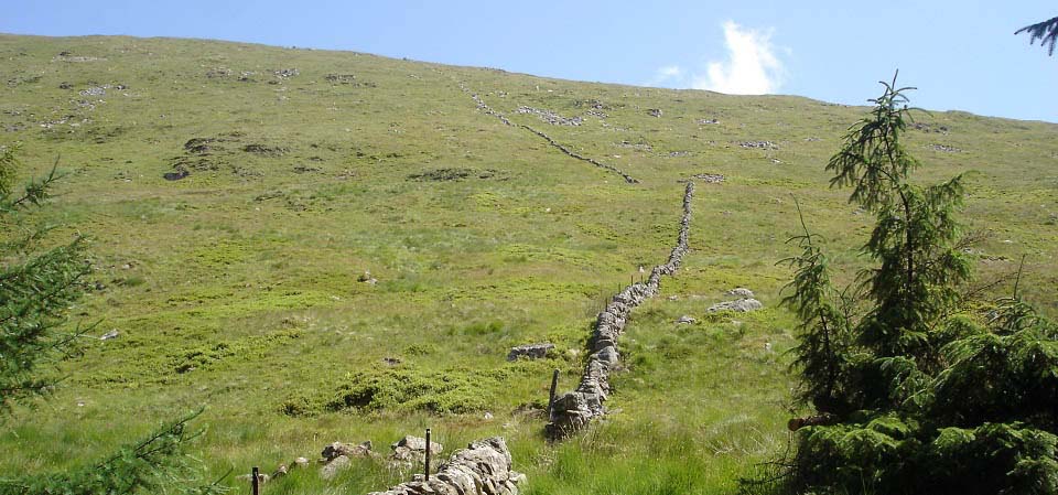
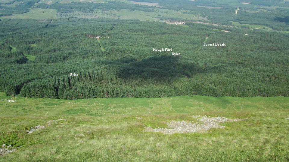
The view below is looking down from the
steep west side of Meaul at the way up. It
is a good forest road that runs up behind
the quary.
Note, all the forest breaks are soggy in
places and a bit rough, so be prepared for
some fairly tough hiking. They started
clearing trees in this area in 2013, so the
views could change a lot soon.
Quad tracks go up this forest break and
follow the dyke for about 200 yards, then
cut off to the right. Where the quad tracks
turn off is a rough patch about 50 yards,
then it is fairly good going the rest of
the way next to the dyke.
Large
Image
|
|
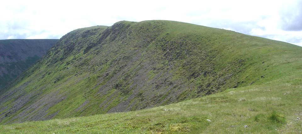
The view below is from between Meaul and
Carlin's Cairn looking south to the 2,648ft
Carlin's Cairn with two cairns on top. This
is the best route to hike up Carlin's
Cairn, as the views are more impressive
from this side.
I took about 1 hour to walk out to the
forest break, about 30 minutes to walk up
the forest break and beside the stone dyke.
It takes about 1 hour to hike to the top of
the range between Meaul and Carlin's Cairn,
a bit longer if you go up the steepest part
of the west side of Meaul. The first 30
minutes hiking up next to the dyke is steep
and tough going, then it levels out a bit.
Once on the top, all the hills are
connected by a good path, that makes for
fairly easy hiking between all the hills on
the range.
Large
Image.
|
|
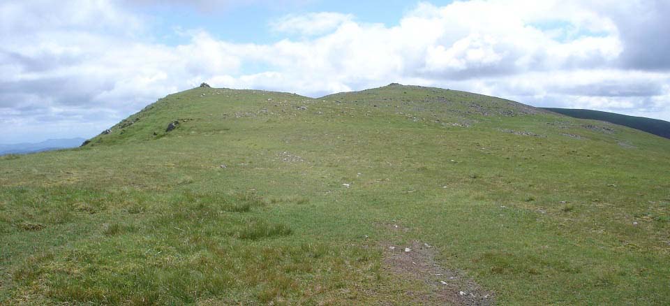
The view below shows the two cairns on
Carlin's Cairn.
|
|
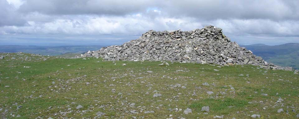
Below is the larger cairn on Carlin's
Cairn. There are great views all around
from here of a number of interesting hills
and lochs.
Large Image
.
|
|
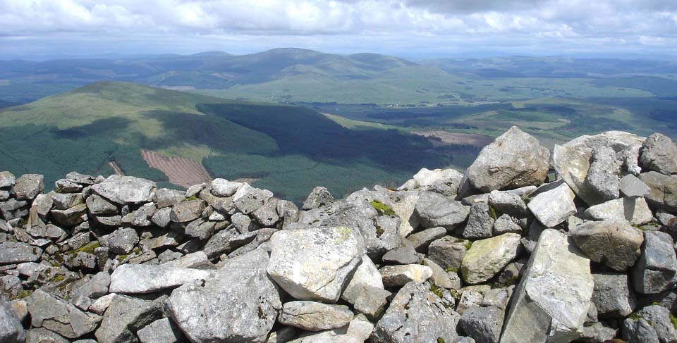
The view below is from Carlin's Cairn
east to the village of Carsphairn and the
2,615ft Cairnsmore of Casphairn behind the
village.
|
|
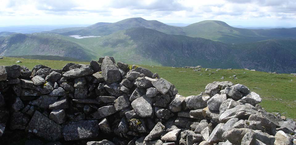
The view below is west towards the
2,270ft Mullwarchar with the 2,766ft
Merrick behind that and the 2,579ft
Kirriereouch to the right of The
Merrick.
|
|
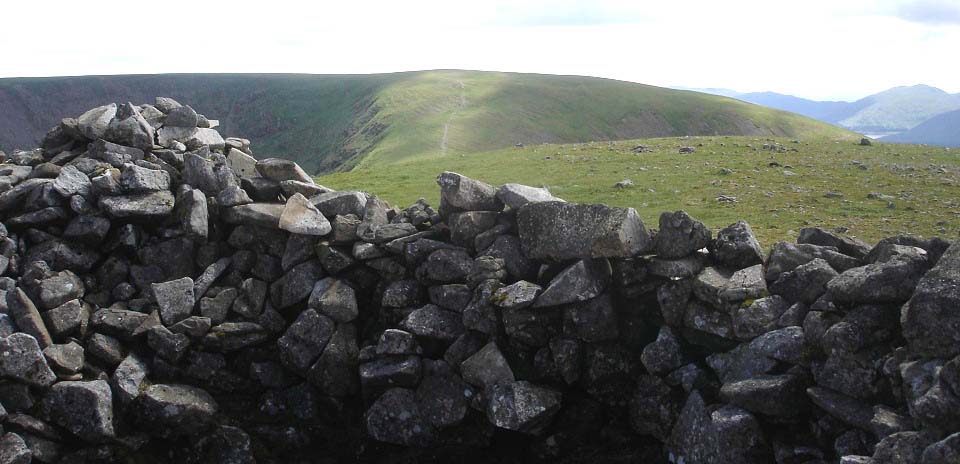
The view below is from Carlin's Cairn
looking south to the 2,671ft Corserine,
highest hill on this range with a horse
shoe shape. There is about a 300 feet dip
between these hills so a bit of tough
hiking is required for the crossing. The
east side of these two hills/mountains have
some steep drops to watch out for if
visibility is poor.
|
|
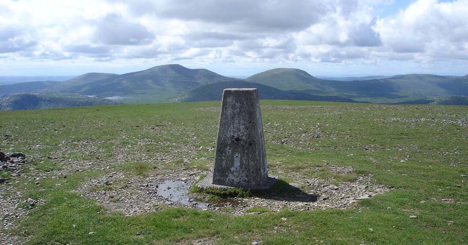
Below is a view from Corserine west to
The Merrick. The 2,034ft Meikle Craigtarson
is in the dip on the west side of
Corserine. Meikle Craigtarson is a bit more
rugged than Corserine and gives great views
over the Mulwarchar range cliffs.
South of Corserine are the 2,349ft
Millfire, 2,421ft Milldown, and 2,457ft
Meikle Millyea. Those hills are a good trek
out and back, so are best hiked from the
hiking car park at the Forest Lodge on
the east side. Map.
Large
Image
Large Image
south to Millfire
|
|
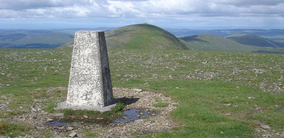
The view below is from Trig Point on
Corserine looking north to Carlin's
Cairn.
Large
Image.
|
|
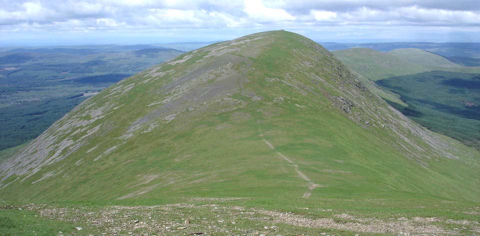
The view below is heading back over
Carlin's Cairn to the north hills and way
back down to the forest road.
Do not go down the west side of
Corserine to the roads down there as those
roads do not run back to Loch Doon. Google
Maps show a road running all the way
through the forest to Loch Doon but there
is no such road, only 2 miles of thick
forest and extremely boggy forest
breaks.
Large Image
.
|
|
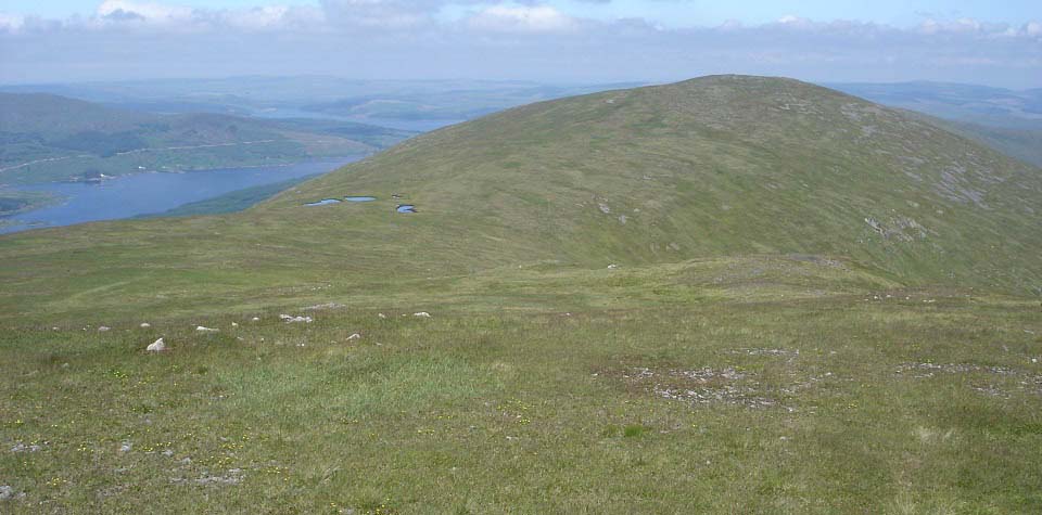
The view below is from the north side of
Carlin's Cairn looking north to the 2,280ft
Meaul, 2,011ft Bow, 2,043ft Coran of
Portmark and Loch Doon.
If you are heading back down, just past
three pools, start to drift over to the
left and follow the stone dyke back down
the southwest side of Meaul.
|
|
If you decide to do all the north side
of the range, the hike to the top of the
2,280 ft Meaul is fairly easy going.
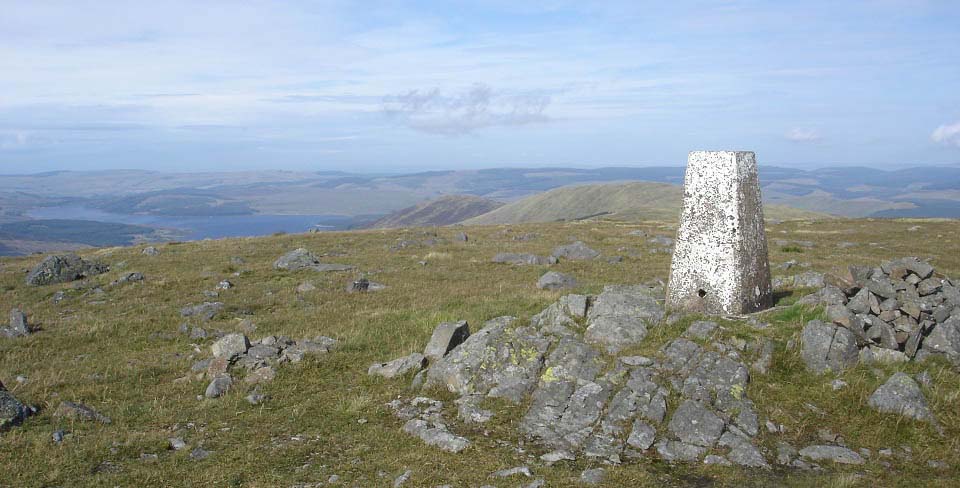
The image below is from trig point on
Meaul looking north to the 2,011 ft Bow.
The images from here were from another hike
later in the year.
East of Meaul is the 2,162 ft
Cairnsgarroch which is connected, probably
take about and hour and a half to go out
there and back.
Large image east to Cairnsgarroch
Hill.
|
|
The route across from Meaul to the 2,011
ft Bow is fairly easy going, just a wet
patch about 50 yards long on the north side
of Meaul to pick your way through. It is
about a 400ft dip down to the lower north
side of Meaul and about 150ft hike up to
the top of Bow. Bow has three cairns on the
top.
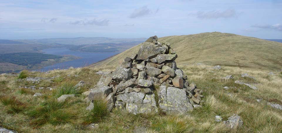
The image below is from the north cairn
on Bow, looking north to the 2,043ft Coran
of Portmark.
If you are only hiking to Bow and Coran
of Portmark, there is a good forest break
from the forest road up behind the quary
that leads to the low point between Meaul
and Bow, probably the fastest way onto this
range.
|
|
The route across to Coran of Portmark is
fairly easy going following the path.
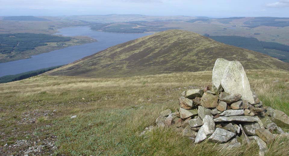
The view below is from the north cairn
on Coran of Portmark looking north to the
1,732ft Black Craig and Loch Doon. There is
a fair dip between Coran of Portmark and
Black Craig, should you want to visit that
hill.
I decided not to bother as it would be a
long way back from there to the way
down.
|
|
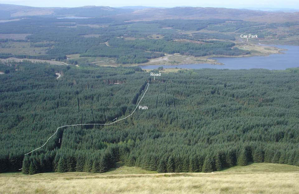
The view below is from between Meaul and
Bow looking at a forest break leading to
the new road at the small quarry. This is a
good way down from here with the quarry
road being the best in the forest. The road
winds its way round to the left, as seen
below, then back round to the car park at
the south side of Loch Doon.
The forest breaks can be a bit wet in
places, I find it easier walking through
the narrow path next to the forest break.
This is probably the fastest way up onto
this range, especially if you bike round
the road. It is only about 500ft from
exiting the forest break to the lowest
point between Meaul and Bow, quite a steep
500ft.
|
|
This is an interesting range with
Carlin's Cairn being the most interesting,
and highest looking hill from the west.
Corserine is more interesting from its
southeast ridge when hiked from Forest
Lodge.
I hiked the whole range in four days,
the first in July from Loch Doon to
Carlin's Cairn, Corserine and Meikle
Craigtarson, in September from Loch Doon to
Meaul, Bow and Coran of Portmark, in
September from Forest Lodge to Corserine,
Millfire, Milldown, and Meikle Millyea, and
in October from the Old Lead Mines to
Cairnsgarroch, Meaul, Bow, Coran of
Portmark, Black Craig and Knockower.
The whole range down the middle has been
hiked in one day, although those who did
stated it was a tough day. This normally
consists of being dropped off at Drumjohn,
or close to the Old Lead Mines just north
of Casphairn for a quick way onto Black
Craig or Coran of Portmark, and being
picked up at the Forest Lodge car park
after descending Meikle Millyea.
The route straight down the middle is
about 14 miles and all the hiking upwards,
up onto the first hill, and up between the
hills, adds up to about 3,800ft.
Gairnsgarroch and Meikle Craigtarson add to
this if they are hiked, but they are
normally missed due to them being off to
the east and west. Route Map.
Corserine Loup from
Forest Lodge
Corserine Tourist
Trail from Forest Lodge
Rhinns of Kells
north hills from the Old Lead Mines
|
|

